Geographic Evolution
This part of the guide, which talks about the geographic evolution of the province of Almeria, is divided into different points, clasificated by areas:
The Almería - Níjar Basin
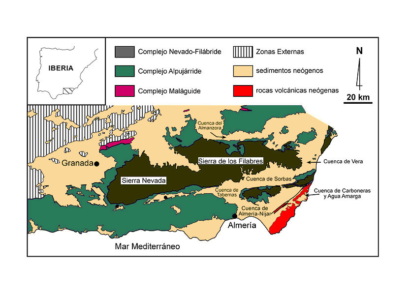
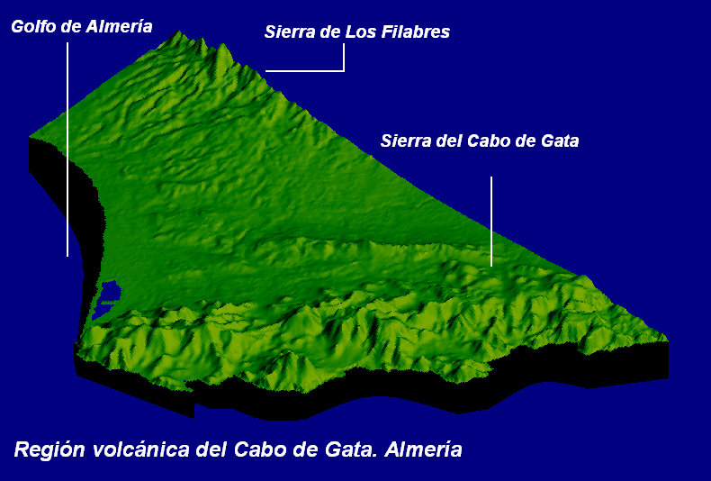
The Almeria-Nijar Basin spans the current low areas situated between Sierra de Gádor, Sierra Alhamilla, Sierra Cabrera and the coastline, including the volcanic relieves of the Sierra de Cabo de Gata.
The Almería-Níjar Basin has been a small marine sedimentary through since 15 million years ago, the time at which emergence of the relieves occurred, that today constitute the Sierra Nevada and the Sierra de los Filabres massifs, whose foothills were located at the coastline. In this period, the Almería Basin was not individualised from the Sorbas and Tabernas basins. In this marine basin, sediments started to arrive from the dismantling of the emergent relieves through the fluvial network, as well as from the volcanic eruptions in Cabo de Gata, that was a volcanic archipelago back then.
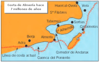
It was much later, about 7 million years ago, when uplift of the Sierra de Gádor and Sierra Alhamilla caused the individualisation of the Almería-Níjar Basin, to the south of these same hills and between the emerged volcanic relieves of Cabo de Gata.
Sierra Cabrera, which emerged 5'5 million years ago, definitively isolated it from the Sorbas and Vera basins.
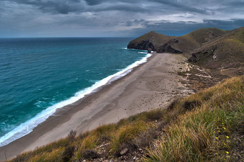
The Cabo de Gata volcanic complex
The Cabo de Gata volcanic complex was formed between 15 and 16 millions of years ago, and it makes up the emerged part of a large magmatic area that is submerged in the Alboran Sea. The best known and conserved volcanic elements are also, the most recents, produced between 9 and 7,5 millions of years ago.
After the first volcanic episodes, the sea invaded the volcanic relieves, generating a large archipelago. In the sea basins between volcanic relieves the store of sea sediments was produced. This, along with the continous submarine volcanic activity, created little by little the unión with the continent, that ended taking the look that it has currently, between 5 and 2 millions of years ago.
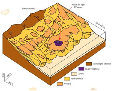
From this volcanic complex we can stand out the “Hoyazo de Níjar”. This volcano was originated by means of the fault called Carboneras, in whose mountainside and summit there are deposits of rocks called granets. Some modern greenhouse has been built in the ancient crater.
The Sorbas Basin
Eight million years ago (in the Upper Miocene), the configuration of land emerged and submerged beneath the sea along the coastal zone of Almería was similar to present, but not identical: the sea spread across the Sorbas Basin, dry land today, up to the foothills of the Sierra de los Filabres, in whose margin reefs of fossil corals from this age remain as testament, closely marking the position of the ancient coastline. On the slopes, submarine fans deposited thick and extensive sediments that the rivers stripped out from the emergent relief. The later emergence of Sierra Alhamilla and Sierra Cabrera configured a long and narrow intermontane marine basin between these new relieves, to the south, and Los Filabres, towards the north, where the deposition of marine sediments continued: this is today called the Sorbas Basin.
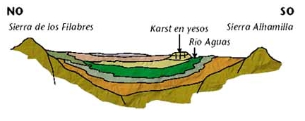
At the end of the Miocene (around 5,5 million years ago, during the Messinian) an enhanced process of desiccation of the Mediterranean Sea caused the marine Sorbas Basin to become practically dry, with a very shallow depth subjected to strong evaporation. In these circumstances a package of gypsum almost 100 metres in thickness was deposited: the Sorbas gypsum. Afterwards, the sea reoccupied its level, continuing the accumulation of marls and detrital sediments above the gypsum, up until, around 3.5 million years ago (in the Pliocene), the coastline progressively retreated until reaching its present position.
The final retreat of the sea meant that the marine sediments became exposed to the action of erosive agents. The removal of the upper sedimentary layers left the highly soluble gypsum subjected to the continuous action of water, which progressively dissolved it. Therefore, one of the most important gypsum karst landscapes in the world for its size, worth and beauty started to form.
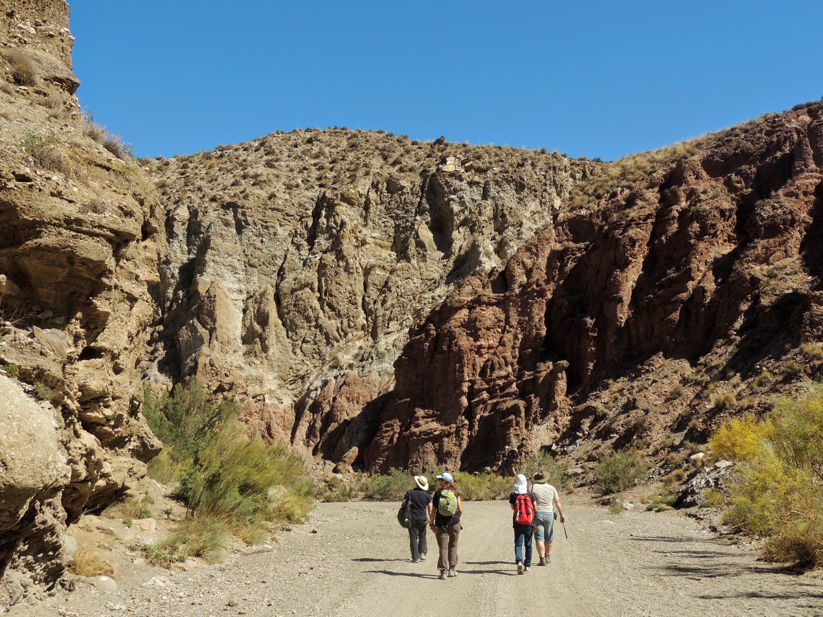
The Tabernas Basin
In the previous points we have explained how the coast has evolved since 8 millions of years ago until now, going through the raising of Sierra Alhamilla 7 millions of years ago.
The Tabernas Basin has been configured since then as a long and narrow depression (approximately 20 km in length and 10 km in maximum width) between the Sierra de los Filabres and the Sierra Alhamilla, situated to the west of the Sorbas Basin and in continuation with it.
The soft nature of the sediments that have filled the Tabernas Basin from 10 to 8 million years ago, the slow and continual uplift of the sierras that border it, and the arid yet stormy climate that has characterised this territory for a good part of the more recent Quaternary, have conditioned the model for one of the most spectacular erosive landscapes in continental Europe.
Geographic evolution of the bay of Almeria
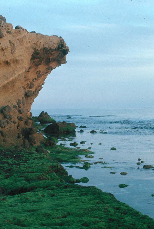
The Bay of Almería and Andarax Valley, Campo de Níjar and area of Roquetas del Mar surrounding it, made up a large sedimentary basin during the Pliocene and Quaternary (since 5.2 million years ago), with material mostly deposited in a marine environment. At the start of the Pliocene the sea occupied all of the present low-lying areas: in the west up to the slope of the Sierra de Gádor, through the Andarax Valley reaching up to the location of Rioja and bordering the Sierra Alhamilla, penetrating across all of the Campo de Níjar where only the Sierra de Cabo de Gata and parts of the Serrata de Níjar were emerged. The Andarax River, that presently discharges into the sea close to Almería and in a northsouth direction, was located further to the northeast, between Rioja and Viator, during the Pliocene
During the Quaternary, as a consequence of repeated climatic changes, alternating cold glacial periods and warm interglacials, the sea level suffered strong variations that could have been in the order of 130 metres. These variations were responsible for continuous changes in the position of the coastline, and for the distribution and abundance of the different marine and continental deposits. In the Bay of Almería a magnificent record of these distinctive sedimentary environments can be observed, ranging from continental (alluvial fans, dune systems, etc.) to littoral and transitional (submarine deltas in ramblas, beaches, lagoons and littoral features, etc.).
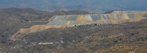
Mining industry in Almeria
Rodalquilar. Gold
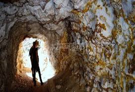
The most known mining activity is the contemporary, initiated in the XIX century, but it’s not the only one.
First, we have the removal and treatment of the alum (alunite),a fixative of the colours for different materials. It was really important during the Middle Age.
The discovery of gold in Rodalquilar(1883) is related to the depletion of the veins of *argentífero* lead that were being exploted in the area since the beginning of the XIX century. The significance of this discovery is that the gold, in addition to the fact that it’s found spread in quartz in the veins, it’s also present in a free state, this means that it’s easier to remove at the foot of the mine. This will be the starting point of a race for looking the profit in the gold of Rodalquilar among local, national and European miners, and even the Spanish government.
Gador. Metals
The sierra de Gádor has been since Prehistory an almost endless source of minerals for the different cultures that have habitated in its surroundings and it has provided metals, since Antiquity, to the whole Mediterranean world and moreover, to the entire Europe.Iron carbonat, sulphur, galenite(sometimes with silver on it), as well as zinc carbonate and zinc sulfate, are the most important minerals that have been exploted since the start of the mining activity in this sierra, adding to the fluorite in the middle of XX century, until the definitive paralysation of the removal in the 70s of this century.
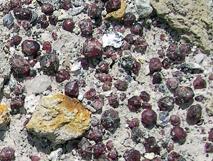
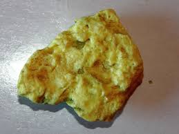
Almagrera. Siver
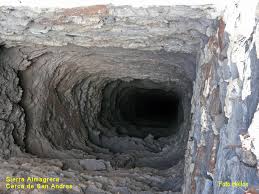
The land of silver, a place that probably was found by accident ended becoming in the origin of the first mining and metallurgical industry of Occident.
In 1839 new veins were discovered in the Jaroso. The most symbolic mineral is the one called jarosite, it’s called like that because of its abundance in this cliff, the more productive one, where 1740 mines were opened.
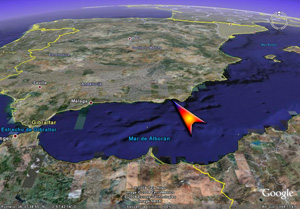
Alborán island
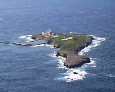
The Alboran island is an spanish islet, with a volcanic origin, practically flat, with 15 meters high clives over the sea level. In its proximities we can find the islote de la nube and some Little rocky places. The most important thing, from a geological point of view, is that it has a volcanic rock that can only be found in this island, the Alboranite.
The Alboran island is one of the last witnesses of the mountain range that, in the Paleozoic, joined together the ancient European and African continents. However, the island as it seems nowadays has a most recent origin. During the alpine folds of the Miocene and the Pliocene(between 20 and 8 millions of years ago), appearing as the remainders of an explosive caldera. The island has submerged many times. This explains the presence of marine sediments in its surface and the noticeable process of erosion, that gives the island that flat look.